
Hingham Neighbors by Block
Hingham neighbors can mean different things. The narrowest meaning is a parcel that touches the starting parcel. A broader block view may include parcels across the road, but a shared street name alone does not establish adjacency. Use the record layer that matches the question, and keep the date with each result because ownership, permits, and community listings change.
| Source | What It Shows About a Block | Access |
|---|---|---|
| Hingham GIS map | Touching polygons, street frontage, buildings, zoning, flood, and historic layers | Public informational map |
| Assessment Data | Current assessed owner, parcel, and value context | Public portal |
| Plymouth Registry | Recorded parties, plan references, and deed identifiers | TitleView, terminals, or copy request |
| Town Clerk lists | Year-specific street-list or permitted voter-list fields | Lawful local request |
| Building permits | Dated work, applicant, address, and posted sign-off context | Online and office files |
| Community directory | Organization category and local community orientation | Public listing, not a member roll |
An assessed owner is not necessarily an occupant. A deed party may be a trustee, estate, or organization. A permit applicant is a project relationship. A municipal list is dated and subject to field restrictions. Treat each as a labeled source, rather than combining them into an unsupported claim about who lives beside an address.
Hingham GIS Neighbor Boundaries
The official Hingham GIS Map routes to Mapsonline, where parcel boundaries, building outlines, flood plains, historic districts, and zoning districts can be compared. Locate the starting address, then inspect the polygon instead of relying on house-number order. Retain every map or lot identifier and note the map date when the viewer displays one.
The town calls the map informational. It is not a survey, legal description, or final zoning decision. That warning matters at corners and rear lots, where a nearby number may have a different street-facing situs address or an owner’s separate mailing address.
The Hingham GIS parcel viewer provides the public map interface used to compare adjacent polygons.
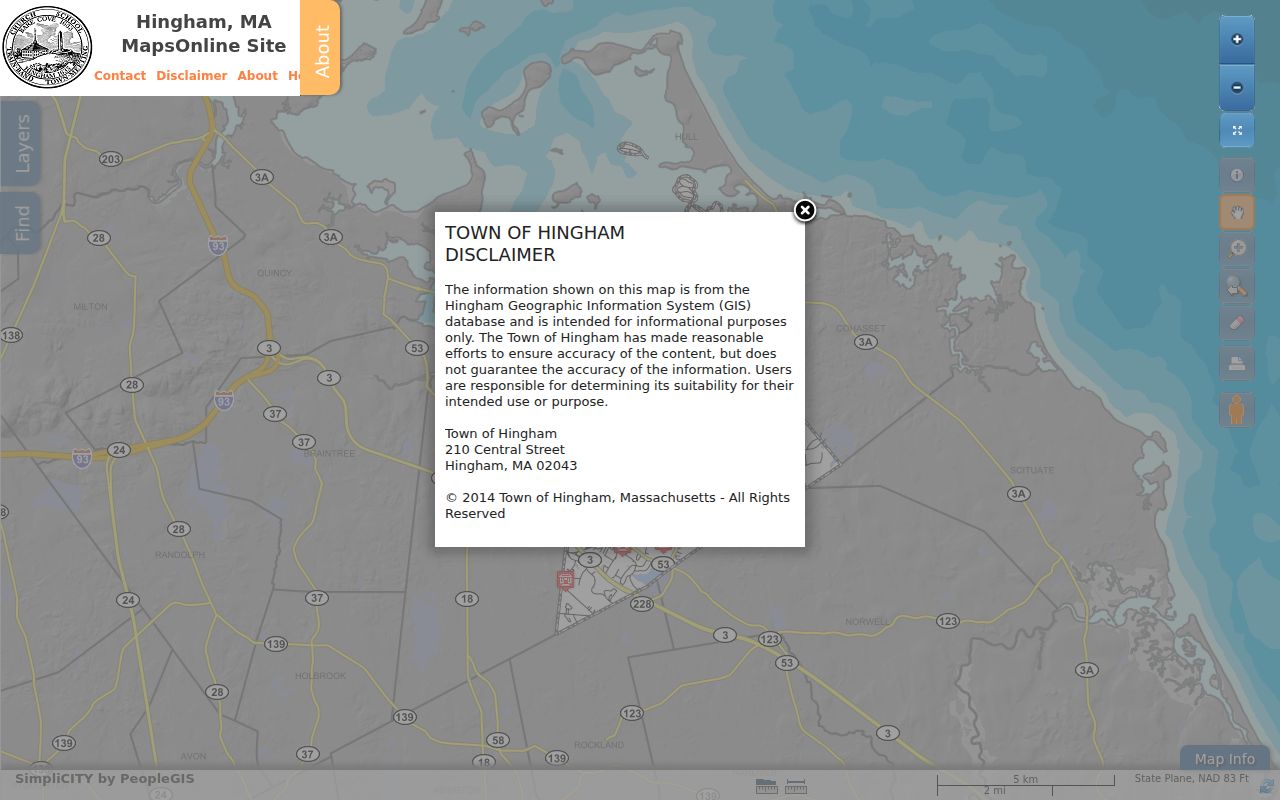
The map is the starting point for Hingham neighbors because it exposes the physical relationship that a street name alone cannot prove.
Map Hingham Neighbors by Parcel
Use one parcel at a time. The flow starts with a property boundary, then carries the parcel identifier through assessment and Registry records. It does not assume that the next postal number is the next parcel, or that an owner of record is the person living there.
- Find the starting address in Mapsonline and record its parcel ID, street-facing situs, and visible map date.
- Identify each touching polygon. Add across-street parcels only when that wider definition of neighbors is needed.
- Open each parcel in Hingham Assessment Data and record the current assessed owner, parcel identifier, and assessment date.
- Search Plymouth TitleView by owner, party, parcel legal description, or plan. Keep the book and page or document identifier.
- Use a permit, street list, or historical directory only when a dated question remains, and label the relationship each source shows.
A shared boundary may be documented by a plan or deed call even when postal numbers are discontinuous. For the longer chain along a named road, use the Hingham street directory rather than expanding a block lookup into a street-wide list.
Hingham Owner and Deed Trail
After GIS supplies the correct polygon, repeat the assessment search for each parcel. Hingham’s current FY2026 values use names and addresses as of January 1, 2025. Search by owner or street address, and use a short street fragment when the spelling is uncertain. The parcel ID bridges the municipal summary to the land-record trail.
In TitleView, search the current owner or party and refine by Hingham, document, date, property, or plan. Retain the recording date, parties, document number or book and page, legal description, and plan reference. An assessed owner and a recorded grantee are separate dated facts. Neither one establishes occupancy.
For early material, TitleView has grantor and grantee index routes and the Registry maintains in-person alternatives. Hingham’s plan index is especially useful when a boundary is described by a lot or plan rather than a current street address.
Older Registry indexes deserve an extra check. The research notes that early recorded-land name indexes can be unedited and may require spelling variants or the printed indexes and original books at Plymouth. Search both grantor and grantee when tracing a transfer because a party changes role from one deed to the next. A plan reference can also reveal the abutter relationship more clearly than a mailing address.
Hingham Neighbor Permit History
Hingham’s permit route allows public existing-permit searches, inspection and sign-off viewing, and related online steps. Permit material can date a construction or alteration question around a block, but it is a property-project record. It does not identify present occupants.
The town’s Permit FAQ states that online listings cover 2010 to the present and warns that 2010 through 2016 data may be incomplete. Earlier street files reach to the early 1980s but are office-only. Some interior alterations and re-roofing may not appear in the public list.
When a time dimension matters, keep the permit date, address, description, and source route beside the parcel ID. This produces a block timeline without attaching a project applicant to a residence claim.
Permit evidence is strongest when it is kept in its own lane. It can show that a project was proposed, permitted, inspected, or signed off at a parcel on a date. It cannot establish a resident’s identity, a private household relationship, or a current boundary. Pair it with the parcel and source date, then return to assessment or Registry records for ownership questions.
Hingham Community Neighbor Groups
The Hingham community directory filters public listings by first letter, category, or name. The inspected community-organizations category showed 21 results, with categories including places of worship, scouting, fraternal groups, arts and museums, nature, neighborhood groups, service and civic groups, and youth sports.
| Community lead | Use as orientation, not a private roster |
|---|---|
| Farm Hills Neighborhood Association | A South Hingham neighborhood lead; do not infer membership or parcel residency. |
| Upper and Lower Gardner Street neighborhoods | Local area terms that can guide map and historical searches. |
| Linden Ponds Residents | Community context only; a reference is not evidence about an individual household. |
The community-directory filter lists organizations with a Hingham physical or mailing address. Listings are not endorsements and do not disclose private member lists.
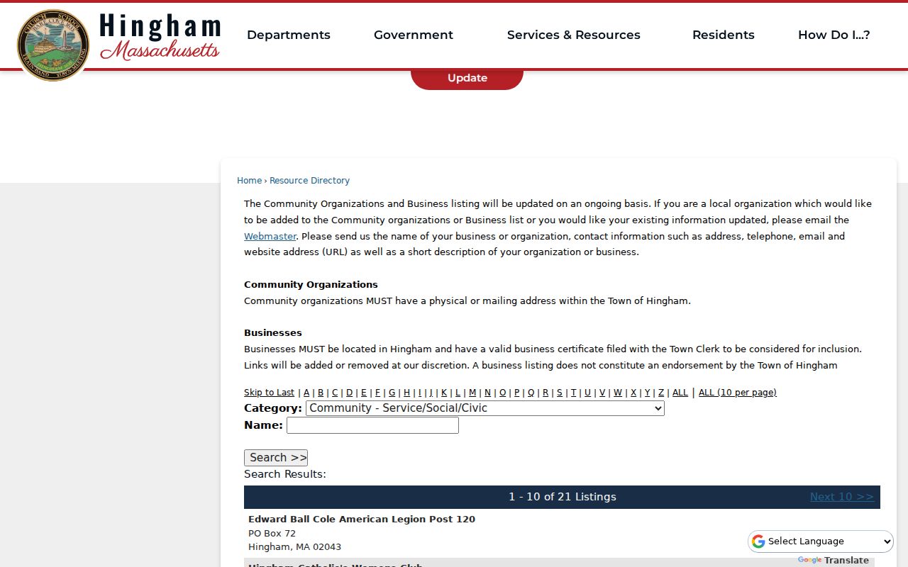
Use organization names as local context or search terms. They should never be used to identify who occupies an adjacent parcel.
For historical orientation, Hingham also has directory, newspaper, and asset-inventory routes. They can identify a past street appearance, original resident, construction date, or local organization in a specified period. Those records are useful for a dated block question, but a historical directory occupant is not a present Hingham neighbor. Date each historical clue before comparing it with the current map.
Hingham Voter List Boundaries
Hingham’s annual street list is a January 1 municipal record that includes residents age 17 and over. The Clerk’s public voter list may include name, address, party, date of birth, active or inactive status, and voter ID. Additional fields can be available on request, but the state central registry is not a general public list.
Phone, email, veteran status, permanent absentee status, minor records, and confidential-voter information are not public. A lawful request to the Town Clerk can answer a specific municipal-list question, yet it should not become a map of protected locations or a block-by-block personal list.
| Official record category | Commercial neighbor-tool category |
|---|---|
| Dated, source-specific parcel, deed, list, permit, or organization record | May combine public and purchased data with unknown update timing |
| Shows a defined relationship and access limit | May blur owner, occupant, and former address information |
| Can be checked with the named custodian | Needs independent confirmation before reliance |
Use the state’s individual voter form only when a specific person’s legal name, full date of birth, and five-digit ZIP are already known. It is not a street or ZIP browsing tool. A no-match can reflect a move, recent registration, a data mismatch, or confidential status. For a lawful local-list question, request the relevant municipal year and accept the Clerk’s field-level limits.
Hingham Neighbors and Postal Addresses
Exact parcel adjacency is not the same thing as sharing a postal street. A corner parcel, rear lot, public way, or unconnected street segment can make nearby numbers look adjacent when their polygons do not touch. A deed may name an abutter who is not the next delivery address.
Keep municipal situs, parcel, deed legal description, and tax mailing address separate. The GIS viewer and assessor use municipal property keys. The Registry may use a lot, plan, or boundary call. A mailing address can belong to an owner, trust, or agent outside Hingham. Confirm the map before calling any parcel a neighbor.
Historic naming can complicate the comparison. Hingham Harbor material identifies Town Street as today’s North Street and Broad Cove Lane as today’s Lincoln Street. Those older names are useful when a deed, directory, or map has no modern street wording. They are not evidence of a townwide renumbering, since the research found no official comprehensive renumbering project.
Note: A same-street label is a useful search clue, but only the parcel geometry supports a claim of direct adjacency.
Hingham Neighbor Privacy Limits
Public parcel work has firm boundaries. Confidential voters are excluded from public voter information, and the Massachusetts Address Confidentiality Program gives eligible survivors a substitute mailing address and mail-forwarding route. Do not use a public record, map, or organization listing to try to identify an actual protected location.
Courts may redact identifying information, and Probate remote access withholds party addresses and protected case categories. Utility and delivery information are not neighborhood records. Keep a source URL, date, and parcel or document identifier rather than copying sensitive details. The existence of a public annual list does not authorize broad republication of every field.
Lawful personal use. Use Hingham neighbor records for a legitimate property, family-history, civic, or community question. Never use them to stalk, harass, surveil, or expose someone’s protected location.
Massachusetts law also limits public access to some court, motor-vehicle, vital, and municipal fields. The public-records route does not override a confidential-voter rule, a court redaction, or an address-protection program. If a block question cannot be answered without protected information, stop with the public parcel and source-date record rather than searching for a way around the safeguard.